
VIC · Northeast Victoria
Read the ground faster around Beechworth — one of Victoria's richest goldfields
Most prospectors walk straight past the best ground near Beechworth. They dig the obvious spots. The gold is in the trap zones — and they're not obvious.
DigMate reads the terrain and shows you exactly where gold settles. The website shows you the area. The app shows you the dig lines.
Open DigMate for BeechworthAI TERRAIN ANALYSIS
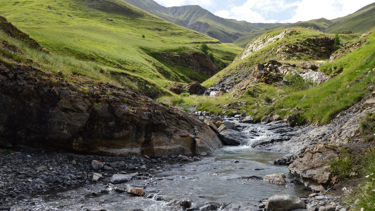
Where gold is actually hiding near Beechworth
Beechworth sits on Ordovician sedimentary rocks intruded by granitic bodies and quartz reef systems. The Spring Creek gorge exposes some of the most productive gold-bearing geology in Victoria. Basalt caps in the area preserve ancient deep lead channels.
Spring Creek, the gorge area, and the surrounds of Lake Sambell are the primary productive systems. Numerous gullies draining the surrounding ranges also carry alluvial gold.
Spring Creek Gorge
WHAT YOU GET
The website shows general zones.
The app shows exact dig lines.
- General gold area overview
- Historical workings summary
- Creek system description
- Top 3 terrain indicators
- 1 zone score (blurred detail)
- Exact dig lines with GPS coordinates
- Full Best Zones overlay (all areas)
- AI terrain scan on any drop pin
- Gold line prediction from your finds
- Trip tracking + finds log
- Rock ID and mineral analysis
- Community intel (ghost pins)
UNLOCK EXACT GOLD LOCATIONS
Scan Spring Creek terrain
Stop guessing. DigMate reads the terrain around Beechworth and shows you exactly where to dig — before you leave home.
Open DigMate FreeFree to start · No credit card required
PROVEN GROUND
Prospectors using DigMate near Beechworth have found…
The Spring Creek rush of 1852 was one of the most productive alluvial strikes in Australian history. Over 4 million ounces were recovered from the Beechworth region during the rush era. Deep lead mining continued well into the 1900s.
"Found colour on my first session using the Best Zones overlay. Would have walked straight past that bend."
"The drop pin AI scan told me exactly where to dig. Saved me half a day of guessing."
"I've been prospecting for 12 years. This is the first app that actually understands how gold moves."
Alluvial gold from fine to coarse. Occasional nuggets still surface. Deep lead gold in ancient buried channels.
mixed
beginner
NEARBY GOLD AREAS
More ground worth checking
COMMON QUESTIONS
Beechworth Gold Prospecting FAQ
Is there still gold at Beechworth?
Yes. Modern prospectors regularly find gold in Spring Creek, the gorge area, and surrounding gullies. The area has been worked for 170 years but the geology is rich enough that productive ground remains.
When is the best time to prospect at Beechworth?
After rain is ideal — fresh gold gets exposed and creek levels drop to reveal bedrock. Autumn and spring are the best seasons. The gorge can be inaccessible in high water.
Can I use a metal detector at Beechworth?
Yes, on state forest land with a valid Miner's Right. The gorge area and surrounding bush are accessible. Avoid any heritage-listed sites within the historic township.
Find hidden trap zones at Beechworth
DigMate shows you the exact dig lines, depth indicators, and trap zones near Beechworth. Plan your session before you leave home.
Open DigMate Free