
How to Read Gold Prospecting Terrain: The Prospector's Field Guide
Gold is heavy. That single fact explains almost everything about where it ends up. Understanding how water moves gold — and where it stops moving it — is the foundation of productive prospecting. This guide covers the key terrain features that concentrate gold in Australian creek systems and reef country.
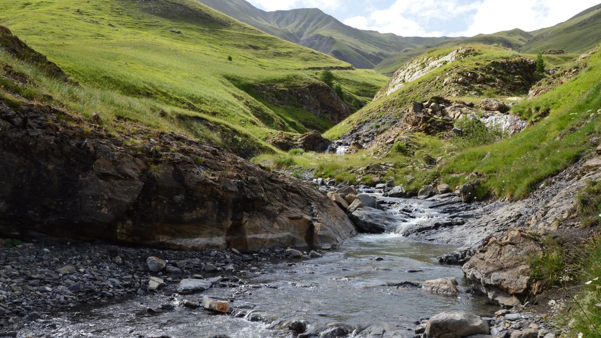
Inside Bends
When a creek bends, the water on the outside of the bend speeds up and the water on the inside slows down. Heavy material — including gold — drops out of the current on the inside of the bend. This is the single most reliable gold trap in alluvial systems. Look for exposed bedrock, clay layers, and gravel bars on the inside of creek bends. These are your primary targets.
Slope Breaks
Where a creek gradient flattens — where a steep section becomes a gentle section — water loses energy rapidly. Heavy material drops out at these transition points. Slope breaks occur where creeks leave steep gully country and enter flatter valley floors, where waterfalls have eroded back to create a step, and where resistant rock bands create a local base level. These are high-priority targets.
Tributary Junctions
Where a smaller creek meets a larger one, the flow energy drops suddenly. Gold carried by the smaller creek settles at the junction. The inside of the angle where the two creeks meet is particularly productive. In historic goldfields, many of the most productive alluvial workings were at tributary junctions.
Reef Contacts
In reef country, gold concentrates where quartz reefs meet different rock types — particularly where reef meets schist, slate, or ironstone. These contact zones are where hydrothermal fluids deposited gold during reef formation. They are also where weathering concentrates residual gold as the reef erodes. In WA, greenstone-granite contacts are the classic nugget zones.
Bedrock Traps
Gold sinks to bedrock. Crevices, potholes, and steps in bedrock are natural gold traps. False bottoms — clay layers above bedrock that mimic bedrock — also concentrate gold. In creek systems, the most productive ground is often the first 30 cm above bedrock. In WA laterite country, shallow bedrock depressions and calcrete horizons serve the same function.
DigMate's AI terrain analysis identifies these features automatically from satellite imagery and elevation data. Enable Best Zones in the app to see AI-scored terrain with a breakdown of which indicators are present at each zone.
Try DigMate FreeFrequently Asked Questions
Where does gold concentrate in creek systems?
Gold concentrates at inside bends, slope breaks, tributary junctions, and bedrock traps (crevices, potholes, false bottoms). These are the areas where water slows and heavy material drops out.
How deep is alluvial gold in Australian creeks?
It varies. In active creek systems, gold may be at the surface or just below gravel. In ancient buried channels (deep leads), gold can be many metres deep. In most accessible creek systems, productive gold is within 1 metre of bedrock.
What is a false bottom in gold prospecting?
A false bottom is a clay or hardpan layer above bedrock that traps gold just like bedrock does. Gold settles on top of the clay layer and accumulates over time. False bottoms are common in Victorian creek systems.
Related gold areas

Related articles

Apply this knowledge in the field
DigMate puts terrain analysis, historical workings, and geological indicators in your pocket. Use it alongside these guides to find ground worth your time.